
GeoCat Live
One platform. No assembly required. Catalogue, map server and desktop GIS, managed as one.
[ GeoCat Live ]
Sharing data was never easier.
GeoCat Live is a managed data space: a catalogue, a map server, a spatial database and GeoCat Bridge, running on a private instance deployed in the country you require. We install it, patch it and monitor it, so your team can publish data instead of maintaining servers.
-
Data catalogue
Findable, searchable metadata for every dataset, geospatial and non-geospatial alike. Built on GeoNetwork open source.
-
Map publication
Publish layers through WMS, WFS, WCS and OGC API. Scalable, and configurable per audience and use case.
-
API access and integration
REST APIs, OGC API Features and CSW endpoints connect the platform to the systems and portals you already run.
-
Branding and configuration
A skinnable interface with your own thesauri, projections and metadata profiles, served from your own domain.
-
Access control and roles
Fine-grained permissions with LDAP and SSO integration, suited to organisations with complex internal structures.
-
Monitoring and updates
Automatic updates, availability monitoring and proactive maintenance, so your team carries minimal admin overhead.
Your data flows freely. No walls.
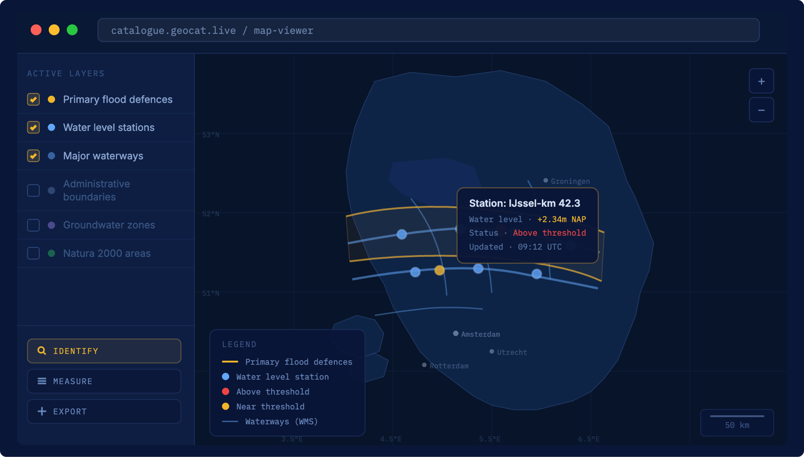
We set it up, you keep working
Your instance is deployed in the country you require and configured with your thesauri, projections and metadata profiles before you touch it. An existing GeoNetwork environment moves across as it is, without a rebuild and without retraining your team.
Patched before you hear about it
Updates, security fixes, monitoring and backups are ours to handle. You get early access to vulnerability information and mitigation advice, on an environment held to 99.00% or 99.50% availability depending on your plan.
Open standards, end to end
REST API, CSW and OGC API Features connect Live to the portals, dashboards and partner systems around it. Nothing is locked in a proprietary format, so your data outlives any single supplier, including us.
The people who wrote the software
Your dedicated contacts and our support desk are staffed by the engineers who lead the GeoNetwork and GeoServer projects. Quarterly consultation keeps the roadmap aligned with what your organisation actually needs.
Ready to start?
[ Pricing ]
Two versions, made to fit your needs
GeoCat Live is renewed yearly, so you always have immediate access to our team of experts and to our latest tested, secure and stable updates.
GeoCat Live Standard
Experience the power of our Software as a Service.
- GeoCat Find Standard and GeoCat Map Standard included
- PostgreSQL with PostGIS extension
- GeoCat Live dashboard, usage and monitoring report
- Built-in security integration
- 99.00% availability, daily data loss prevention
- Standard production server, 5 TB transfer per month
- Maximum response time from 1 day
- Ongoing service updates
GeoCat Live Premium
Enjoy complete comfort and peace of mind.
- GeoCat Find Premium and GeoCat Map Premium included
- PostgreSQL with PostGIS extension and pgAdmin
- Security integration with IP range and VPN restrictions
- 99.50% availability, hourly data loss prevention
- Premium production server, 10 TB transfer per month
- Pre-production environment included
- Maximum response time from 2 hours
- Roadmap discussion twice a year
[ Open standards ]
Built on international norms
GeoCat works seamlessly with international geo-standards. No vendor lock-in: your data stays yours, portable, interoperable and published through standards any system can read.
[ Why open source ]
What open source means in practice
[ Customer stories ]
Managed data infrastructure, in production




[ FAQ ]
Questions about GeoCat Live

Other questions
Let us know
GeoCat Live is available as a subscription, either as a managed cloud service or installed within your own infrastructure. The cost depends on your setup, the scale of your data environment and the level of support you need. There are no licence fees for the underlying software. What you pay for is the platform, the maintenance and the expertise around it. Contact us for a quote that fits your situation.
With cloud hosting, GeoCat runs and maintains the platform on your behalf: a fully managed environment with automatic updates, security patching, monitoring and a guaranteed availability of 99.00% or 99.50%, depending on the plan. With on-premise, GeoCat Live is installed within your own infrastructure, so you keep full control over your environment, meet your internal compliance requirements and decide exactly where your data lives. Both options run the same platform. The difference is location and who manages the infrastructure.
Yes. GeoCat Live started as a geospatial platform, but organisations increasingly use it to manage and publish broader data collections: policy documents, research datasets, administrative records. The catalogue handles both geospatial and non-geospatial data in a single searchable environment. For ministries and agencies that need one place to manage what data exists, who owns it and how it can be used, that flexibility matters.
Esri is a closed, proprietary platform. GeoCat Live is built on open source software and open standards. That means no licence fees for the underlying technology, no vendor lock-in and full control over your data. Your data stays in open formats, published through standards that any system can use, so you are never dependent on a single supplier to keep your infrastructure running. For organisations working under INSPIRE or national geospatial requirements, GeoCat Live meets those standards out of the box.
It means the software is transparent, independently verifiable and not controlled by a single commercial party. You can inspect the code, audit what it does and be confident it will not change direction because a vendor decided to reprice or discontinue a product. It also means the software is tested by thousands of users worldwide every day. When one organisation funds a new feature, it goes back to the community, and the next organisation inherits it for free.
No. GeoCat Live is a managed platform. We handle the setup, the hosting, the updates and the security, so your team works with the data, not the infrastructure. For specialists who manage data day to day, Bridge connects directly to QGIS or ArcGIS Pro. For end users, Find makes data searchable in plain language. No knowledge of WFS endpoints or metadata schemas required.
Stop maintaining servers. Start publishing data.
Tell us what you publish and who needs it, and we will show you what Live takes off your hands.
Other solutions
All solutionsServices and Training
Consultancy, training and support on GeoCat software and the open source stack behind it.
Services and Training