
GeoCat Map
Publish once through open standards. Work everywhere.
[ GeoCat Map ]
Publish once. Work everywhere.
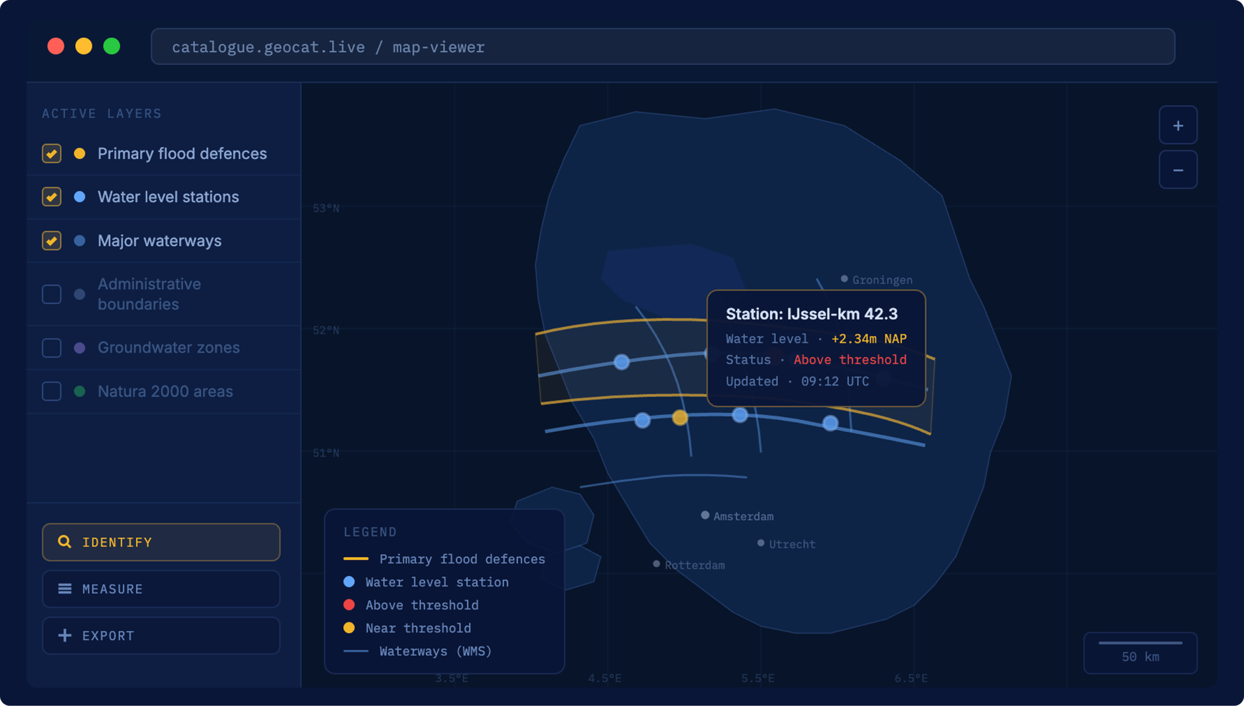
GeoCat Map is our enterprise distribution of GeoServer: OGC-certified web services that publish your layers over WMS, WFS, WCS and OGC API, so any system that speaks open standards can pull them in without conversion. Direct access to vector and raster content, rich cartographic styling, and integration with your database, file and cloud storage.
[ Why Map ]
Built to serve, at scale
One source, every protocol
Your layers go out through WMS, WFS, WCS and OGC API at once. QGIS, ArcGIS, web viewers and national portals all speak what Map serves. Nothing needs translating on either end.
Built for heavy traffic
A national geoportal pulling from dozens of sources; a water authority serving many partner organisations at once. Map is built for large volumes, high concurrency and continuous availability.

Styled and configurable
Layers can be styled, filtered and configured per audience and use case. What a developer sees can differ from what a citizen portal displays, served from the same source.
Long-term support, either way
Run Map on your own servers or as part of GeoCat Live. Both come with up to 5 years of life-cycle support, early access to security fixes, and a distribution tested and preconfigured with the extensions you selected.
[ Pricing ]
How to get GeoCat Map
Map ships with every GeoCat Live plan, or runs standalone on your own infrastructure.
With GeoCat Live
Map is part of every GeoCat Live plan.
- GeoCat Map Standard or Premium
- Hosted and managed by GeoCat
- Same uptime, security and support as Live
- Nothing extra to set up
Your infrastructure
Run on your own servers, with a tailored quote.
- Deployed in your own environment
- Serves WMS, WFS, WCS and OGC API
- INSPIRE-compliant by default
- Request a tailored quote
[ Customer stories ]
Serving geospatial data at national scale


[ FAQ ]
Questions about GeoCat Map

Other questions
Let us know
Esri is a closed, proprietary platform. GeoCat Live is built on open source software and open standards. That means no licence fees for the underlying technology, no vendor lock-in and full control over your data. Your data stays in open formats, published through standards that any system can use, so you are never dependent on a single supplier to keep your infrastructure running. For organisations working under INSPIRE or national geospatial requirements, GeoCat Live meets those standards out of the box.
It means the software is transparent, independently verifiable and not controlled by a single commercial party. You can inspect the code, audit what it does and be confident it will not change direction because a vendor decided to reprice or discontinue a product. It also means the software is tested by thousands of users worldwide every day. When one organisation funds a new feature, it goes back to the community, and the next organisation inherits it for free.
With cloud hosting, GeoCat runs and maintains the platform on your behalf: a fully managed environment with automatic updates, security patching, monitoring and a guaranteed availability of 99.00% or 99.50%, depending on the plan. With on-premise, GeoCat Live is installed within your own infrastructure, so you keep full control over your environment, meet your internal compliance requirements and decide exactly where your data lives. Both options run the same platform. The difference is location and who manages the infrastructure.
GeoCat offers onboarding, quarterly consultation and up to 5 years of life-cycle support. Furthermore we pro-actively monitor and resolve vulnerabilities, inform customers of mitigation procedures and more. A support desk is available for questions and issues.
No. GeoCat Live is a managed platform. We handle the setup, the hosting, the updates and the security, so your team works with the data, not the infrastructure. For specialists who manage data day to day, Bridge connects directly to QGIS or ArcGIS Pro. For end users, Find makes data searchable in plain language. No knowledge of WFS endpoints or metadata schemas required.
Put your geospatial data to work
Tell us what you publish and who consumes it, and we’ll show you how Map fits in.
Other solutions
All solutionsServices and Training
Consultancy, training and support on GeoCat software and the open source stack behind it.
Services and Training